
Brownstown Township ZIP Coverage
Five ZIPs are commonly associated with Brownstown Township territory or neighboring postal routes: 48134, 48173, 48174, 48183, and 48193. They are useful research leads, not a list of township limits. Brownstown has a fragmented geography and no dedicated post office was reported in local regional coverage, so the postal place on an address often names Flat Rock, Rockwood, Romulus, Trenton, or Riverview instead of Brownstown. A mailing label therefore needs a parcel-level check before it is used to identify a municipality or a person.
| ZIP | Approximate Brownstown research area | Postal office lead | Verification note |
|---|---|---|---|
| 48134 | Southern or western-edge candidate route | Flat Rock | County-map approximation; check the individual parcel. |
| 48173 | Southern, river-adjacent candidate route | Rockwood | Keep the historical Rockwood jurisdiction distinct. |
| 48174 | Western-edge candidate route | Romulus | Does not establish a Romulus municipality or occupancy. |
| 48183 | Eastern or southeastern candidate route | Trenton | A Trenton postal label can accompany a Brownstown tax parcel. |
| 48193 | Northeastern or eastern candidate route | Riverview | A Riverview postal label can differ from the township municipality. |
The Wayne County ZIP map is the source for these approximate postal-area leads. It was produced in September 2019 following the 2010 Census. A regional source called the area a six-ZIP service area, but no official USPS list assigning every Brownstown parcel to a postal route was located. Treat any additional route as unconfirmed until an address is returned by USPS and matched to a parcel record.
Brownstown Township Postal Labels
Postal city, township, and parcel are separate facts. A mailing city tells the Postal Service where a delivery address is routed; the Wayne County municipality field and Brownstown Township property record answer a different geographic question. This matters most where the township borders or is separated by incorporated places. An address may use Trenton or Riverview in its postal form while the tax account, assessment card, or GIS geometry points to Brownstown Township.
Keep both forms when recording a result: the original printed address, its standardized street form, postal city, state, ZIP+4 when supplied, township or municipality, parcel ID, and source date. Historic directories may use a neighboring postal name or an earlier municipal name. Replacing it with a modern label can hide the very discrepancy that explains a missed search result.
Note: A ZIP result is routing evidence, not proof that every address using that ZIP lies in Brownstown Township.
Brownstown Township USPS ZIP Lookup
USPS ZIP Code Lookup is the right first check for delivery normalization. Its address mode allows an optional company, requires the street address, city, and state, and accepts optional apartment, suite, other-unit, and ZIP entries. USPS also provides a city-and-state mode and a ZIP-to-city mode. Those modes identify postal routing data only. USPS warns that a result does not confirm that a person or company is actually at the address and cannot guarantee an actual location.
| USPS address-mode field | Requirement or use |
|---|---|
| Company | Optional. |
| Street address | Required address input. |
| Apartment, suite, or other | Optional unit detail. |
| City | Required. |
| State | Required. |
| ZIP | Optional in address mode; required for the ZIP-to-city mode. |
Open the USPS address lookup with the original street spelling and postal city first. The captured interface shows the address, city/state, and ZIP lookup choices used to test a mailing address.
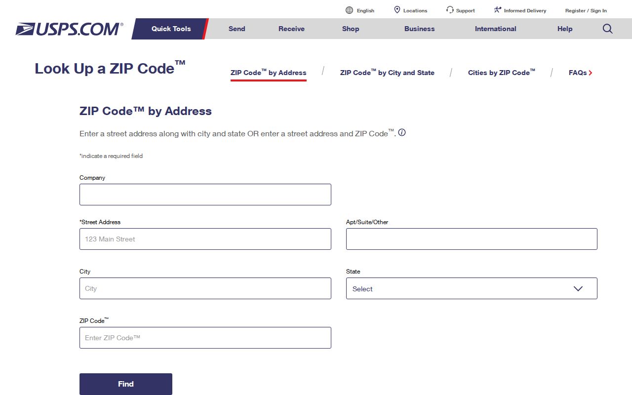
Record the returned city and ZIP with the date and lookup mode, then compare it with the township and parcel sources. The result should not be used to identify an occupant.
Brownstown Township ZIP Research
A ZIP can narrow a postal question, but no official township-wide resident roll searchable by ZIP was located. The Wayne County Treasurer portal has no ZIP field. Brownstown BS&A basic search also does not expose a confirmed ZIP filter, and the inspected GIS service is a parcel and address layer rather than a postal or resident layer. A ZIP search works best as an address-verification sequence, not as a way to create a roster of people.
- Run the complete address through USPS and save the postal city and returned ZIP.
- Search the Wayne County Treasurer property-tax portal by street or parcel ID, selecting Brownstown Twp in the municipality menu when appropriate.
- Cross-check the address, name lead, or parcel number in Brownstown Township BS&A, then note the published situs and parcel fields.
- Use the Wayne County GIS parcel viewer to inspect the selected parcel, road context, and adjacent municipal geography.
- For a defined, lawful voter-record request, use the state QVF request process by jurisdiction and date range rather than implying that individual voter lookup is a public ZIP roster.
Once the parcel and road are settled, the Brownstown Township street directory provides the separate address-focused record trail. Parcel ownership, taxpayer, mailing recipient, and occupant still require different evidence and should never be merged automatically.
Brownstown Township ZIP Parcel Check
The Treasurer form supports street number, street name, municipality, and parcel ID searches. Its instructions recommend at least the first three letters of a street name, no suffix, and a partial or blank street number for a broader street search. Brownstown Twp appears in its municipality selector. For a non-Detroit parcel ID, the county describes a 14 to 16 character number without spaces or dashes. These are property-search keys, not postal fields.
The Treasurer result should be compared with the BS&A property card and GIS point. BS&A can search by address, name, or parcel number and may display property address, parcel or account numbers, owner or taxpayer information, legal description, sales, values, building details, and municipal modules where published. A name on an assessment or tax record can be a useful title or account lead, but it does not establish residence at that address.
The Wayne County Treasurer portal shows the municipality selector used to keep a postal-city result separate from the local tax jurisdiction.
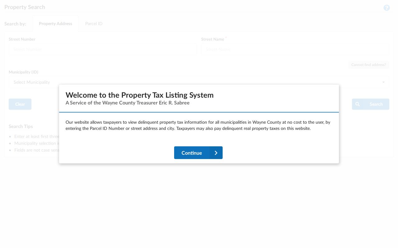
Match the portal result to the parcel map before treating a postal label as a Brownstown Township location. A no-result may reflect street formatting, a historic parcel number, or the wrong municipality.
Brownstown Township Postal History
Brownstown Township's current shape helps explain why neighboring postal names persist. The original township was about 43 square miles before later annexations and incorporations changed the local map. Gibraltar formed in 1961, Rockwood incorporated in 1964, and Woodhaven and Flat Rock incorporated in 1965. A historic address can therefore need Brownstown, Monguagon, Gibraltar, Rockwood, Woodhaven, or Flat Rock as a date-appropriate jurisdiction search term.
This local history is especially important for a postal mismatch. A 48173 Rockwood label may be a southern or river-adjacent clue, while a 48134 Flat Rock label may be a southern or western-edge clue. Neither label alone settles the historic or present municipality. Preserve the street, postal label, legal description, year, and parcel clues together so a deed, directory, census, or map search can be checked in the right jurisdiction.
Brownstown Township ZIP Leads
The September 2019 Wayne County map supplies five named postal leads around Brownstown Township, while the regional six-ZIP statement remains unresolved. That is a useful number to document because it prevents a map approximation from becoming a claim of parcel-level coverage. The map follows the 2010 Census and should be treated as a dated postal reference, not as a current legal boundary or a tally of township residents.
The narrowest reliable conclusion is that 48134, 48173, 48174, 48183, and 48193 recur in Brownstown-area research. The wider conclusion, that every Brownstown address belongs to one of a fixed set of routes, is not supported by the materials inspected. When the postal value and the tax municipality disagree, keep both and let the parcel ID, GIS geometry, and record date explain the difference.
Note: The county map is useful for finding a route to verify, but USPS and parcel records control the address-level check.
Brownstown Township ZIP Boundaries
ZIP boundaries and Brownstown Township limits do not line up. The township is fragmented, and its nearby postal labels are assigned for mail delivery rather than municipal government. Research specifically notes common mismatch patterns: a 48183 Trenton postal city with a Brownstown municipality, and a 48193 Riverview postal city with a Brownstown parcel. A postal city can also be the better search input for a legacy address, even when the township is the correct tax jurisdiction.
Use postal data to normalize an address, then use the municipality selector, assessment card, and GIS parcel geometry to confirm the place. The county map is not a survey, and a ZIP code is not a legal description. For a title or historical question, parcel ID, subdivision, lot and block, legal description, and recorded instrument details are stronger location keys.
- ZIP and ZIP+4
- A ZIP identifies a postal routing area. ZIP+4 adds a more specific delivery segment when USPS supplies it; neither one establishes municipal jurisdiction.
- PO-box ZIP
- A ZIP assigned to post-office boxes routes mail to those boxes. The research did not identify a Brownstown-specific PO-box route, so none is listed as township coverage.
- Unique ZIP
- A ZIP used for one organization or large delivery destination. The research did not verify a Brownstown-specific unique ZIP, so it should not be inferred from a nearby postal label.
- Carrier route
- A delivery sequence used by mail carriers. It is more granular than a broad postal area, but it is not a township boundary or a resident list.
Brownstown Township ZIP Verification
Keep a short quality record for each address: the form submitted to USPS, returned city and ZIP, date, lookup mode, Treasurer municipality, parcel ID, GIS point, and a plain-language mismatch explanation. That record makes it possible to revisit a result when a street suffix, historic road name, or municipal label changes. It also keeps a routing answer from being mistaken for a residency finding.
Do not publish a ZIP list as proof that every person using that route lives in Brownstown Township. Use the smallest amount of information needed for lawful family-history, title, civic, archival, or consumer-safety research. Stop at protected-address boundaries and do not use records to stalk, harass, intimidate, or harm anyone.